Bikepacking the Huascarán Circuit
This Article originally appeared on The Radavist in 2016
Last time I was in Peru, the main focus of the trip was centered around circling the highest mountain in the country, Nevado Huascarán. The route has that perfect combination of spectacular scenery, challenge, and culture, so I knew I’d have a hard time resisting going for it again on my way south this time. The fact that the forecast called for clear skies the whole time sealed the deal. Last time I was here, the mountains were engulfed in rain clouds virtually the entire time, so I never really got to see many of the massive glacial peaks that dominate the route.
This time I started from the north, taking the opposite direction and climbing the relentless Portachuelo De Llanganuco from Yungay toward the pass at nearly 15.5k feet. I planned it out to camp in the Llanganuco valley (so I could get harassed by curious mules all night), and finish the climb the next morning.
The long slog up the final 29 switchbacks took longer than I’d like to admit, with plenty of “photo breaks” (definitely not because I felt like taking a nap most of the time…). Luckily the scenery is so wild it’s easy to find a good excuse to stop pedaling for a bit. After the rain-soaked and fogged-in version of Llanganuco last year, it was nice to take in the 360 degree views on a day that couldn’t have been more blue-skied.
A long rolling descent winding around various lagunas into the quiet village of Yanama finished off the day and had me rolling into the Plaza De Armas (the town square featured in almost every Peruvian city) just after dark. These are the moments when it seems like time stands still around you. Every surrounding conversation pauses momentarily while curious looks and greetings come at you from all angles.
After spending the night in Yanama I headed out of town on the very quiet Pupash pass toward Chacas. This is where the eastern slopes of the mighty Punta Olimpíca truly begin, with the road turning to pavement for the first time on the route.
Like Llangancuo, this one seems to go on forever, doing the familiar ascent into a steep-walled valley before twisting around in a swirl of switchbacks as you approach the summit. Right before hitting the highest tunnel in the world, an old dirt road appears and (if you’re feeling up for it) sends you an extra 600 feet into the sky toward just shy of 16,100ft.
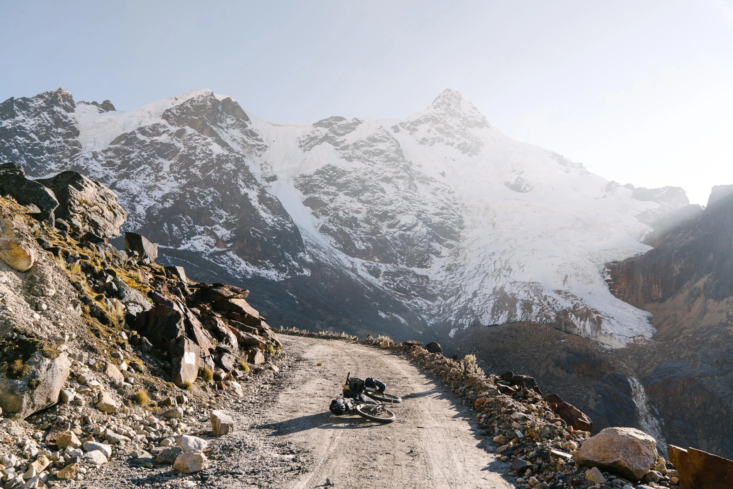
Before tackling the rest of the climb I decided I’d set up camp in a perfect spot just off the old dirt road underneath a towering Nevado and overlooking Laguna Cancaragá. I say perfect, though that only really applies to the sights and sounds. The reality of camping north of 15k ft in the Cordillera Blanca is that the temperatures dip well below freezing, there is a significant lack of oxygen, and there are frequent eruptions of glacial ice crashing down from above toward the laguna. All of which make it tough to actually sleep.
I awoke early to the gift of a layer of frost covering everything I own, and in seeing the sun hitting sections of the road above me, I figured I’d head toward the light rather than freeze to death waiting for it to come to me.
With the tunnel built to bypass this hazard-prone section a few years ago, the condition of the old road to the true summit seems to be deteriorating on a daily basis. The reality is that it is one good slide away from potentially not being passable at all, so if you’re looking to experience this loop in it’s truest form, the time is now!
After the draining push to the summit and a loose descent down the rocky dirt road on the other side, a glorious 30 miles of pristinely paved switchbacks descend toward the city of Carhuaz. With every inch, a bit more oxygen, and suddenly the aches, pains, and fatigue start to drift away from memory knowing that the hard work is done… for now.
The Route


